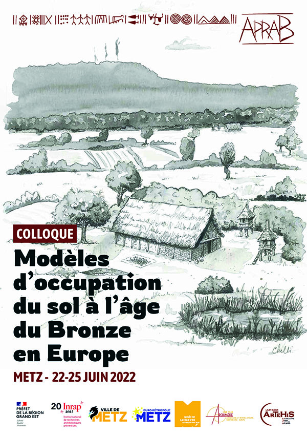
Plus de 30 ans après le colloque de Lons-le Saunier (1990), « L’habitat et l’occupation du sol à l’âge du Bronze en Europe », il est temps de revenir sur cette thématique des modes d’occupation de l’espace. L’attention se polarisait alors sur la connaissance de la structure de l’habitat, de la ferme isolée au village, du « modèle lorrain » de la ferme itinérante sur un territoire contrôlé aux maisons groupées. Les actes du colloque faisaient aussi la promotion des territoires théoriques, via les polygones de Thiessen.
Actuellement, ces images d’un paysage de l’âge du Bronze vu comme un territoire éclaté en de nombreuses fermes, aux rares centres de pouvoir, cette réalité « exclusive » d’un monde agricole dispersé ne répond plus totalement aux fonctionnements sociaux de populations bien plus mobiles qu’il était envisagé il y a quelques décennies. En effet, les échanges de matières premières, de produits, de savoir-faire et d’innovations techniques impliquent de nombreux contacts interpersonnels.
Dans la version 2022 de Metz, il conviendra de porter attention à tous les faits d’origine anthropique qui illustrent une mainmise sur l’environnement naturel et qui de fait peuvent révéler des systèmes d’exploitation, et des modalités récurrentes d’occupation de l’environnement par les populations.
On sera donc attentif à traiter bien sûr des habitats, de plaine et de hauteur, des milieux littoraux et humides mais aussi des champs et terres cultivées et des indices d’anthropisation générale de l’environnement, de l’organisation et de la répartition des nécropoles, de la dispersion et concentration des produits artisanaux (trouvailles isolées et dépôts), des indices de mobilités organisées (chemins, voies, gués).
Si certaines situations et exemples ponctuels peuvent être illustratifs de cette question de l’occupation et de l’usage de l’espace par les populations de l’âge du Bronze, il sera indispensable de privilégier les synthèses et de traiter des corpus significatifs de données.
Il serait souhaitable d’aboutir à des propositions de modèles des structures économiques et sociales des populations de l’âge du Bronze.
Le développement de l’archéologie préventive a produit une abondance de données, certes inégalement réparties au sein des territoires, mais ces corpus renforcés autorisent justement ces traitements statistiques et synthétiques indisponibles dans les décennies précédentes. Une approche territorialisée découle de ces contraintes opérationnelles de l’archéologie préventive et les grandes vallées, les secteurs actuellement densément occupés procurent une grande masse d’informations ; une attente de synthèses locales et régionales est donc forte pour cette rencontre de Metz.
Il faut cependant promouvoir des études de large envergure qui peuvent corriger ces effets de blancs dans la connaissance couvrante des espaces géographiques grâce au développement d’hypothèses et propositions prédictives favorisées par l’usage des technologies liées au SIG.
Les représentations rupestres interprétées comme des espaces ou territoires cartographiés dont certaines sont attestées dès l’âge du Bronze pourront également être mobilisées.
Ce colloque est ouvert à tous les archéologues, bioarchéologues, géomorphologues ou paléoenvironnementalistes travaillant sur la question des occupations de l’espace à l’âge du Bronze. Tous les milieux sont concernés par cette interrogation et le cadre géographique retenu concerne la France, mais plus largement l’Europe occidentale, du monde nordique au pourtour méditerranéen.
Raum- und Landnutzungsmodelle in der Bronzezeit in Europa
Mehr als 30 Jahre nach dem Symposium von Lons-le Saunier (1990), "Besiedlung und Landnutzung in der Bronzezeit in Europa", ist es an der Zeit, zu Thema der Raum- und Landnutzungsformen in der Bronzezeit zurückzukehren. Die Aufmerksamkeit richtete sich damals auf die Kenntnis Besiedlungsstruktur, vom isolierten Bauernhof bis zum Dorf, vom "lothringischen Modell" des sich verlagernden Einzelgehöftes auf einem begrenzten Territorium bis hin zu gruppierten Häusern. Der Tagungsband förderte auch die Diskussionen zu theoretischen Raumnutzungsmodellen, basierend auf Thiessen-Polygonen.
In der heutigen Zeit, in der unser Bild einer bronzezeitlichen Landschaft als ein durch zahlreiche Einzelgehöfte gegliedertes Territorium mit wenigen Machtzentren geprägt ist, entspricht diese "exklusive" Realität einer stark gegliederten landwirtschaftlichen Welt nicht mehr in vollem Umfang dem Sozialgefüge von Bevölkerungen, die viel mobiler sind, als man es sich noch vor einigen Jahrzehnten vorgestellt hat. Denn der Austausch von Rohstoffen, Produkten, Know-how und technischen Innovationen beinhaltete zahlreiche zwischenmenschliche und gesellschaftliche Kontakte.
Anlässlich des Kolloquiums 2022 von Metz soll die Aufmerksamkeit vor allem auf alle anthropogenen Faktoren gerichtet werden, die eine Kontrolle, Ausbeutung oder Umgestaltung der natürlichen Umwelt veranschaulichen und die wiederkehrende Raum- und Landnutzungen durch die bronzezeitlichen Bevölkerungsgruppen veranschaulichen.
Wir werden uns daher mit den Lebensräumen, sowohl in der Ebene als auch in den Höhenlagen, mit den Küsten- und Feuchtgebieten, aber auch mit Feldern und kultiviertem Land sowie mit Hinweisen auf die allgemeine Umgestaltung der Umwelt durch den Menschen befassen; ferner mit der Organisation und Verteilung der Gräberfelder, der Verbreitung und Konzentration von handwerklichen Produkten (Einzelfunde und Deponierungen) sowie mit den Hinweisen auf organisierte Mobilität (Wege, Pfade, Furten).
Obwohl bestimmte Situationen und spezifische Beispiele die Frage nach der Besiedlung und Nutzung des Raumes durch bronzezeitliche Bevölkerungen illustrieren können, wird es unumgänglich sein, Synthesen zu bevorzugen und diese mit bedeutenden Datenbeständen zu hinterlegen.
Es wäre wünschenswert, Modellvorschläge für die wirtschaftlichen und sozialen Strukturen der bronzezeitlichen Bevölkerung zu erarbeiten.
Die Entwicklung der präventiven Archäologie hat eine Fülle von neuen Ergebnissen hervorgebracht, die sich zugegebenermaßen geographisch ungleichmäßig verteilen, aber diese neuen umfangreichen Datenbestände erlauben nun statistische Modelle und synthetische Darstellungen, die in früheren Jahrzehnten nicht möglich waren. Ein räumlicher Ansatz ergibt sich aus den operativen Zwängen der präventiven Archäologie, bei denen insbesondere die großen Täler und die derzeit dicht besiedelten Bereiche eine große Masse an neuen Informationen geliefert haben. Zur Tagung in Metz werden daher besonders lokale und regionale Synthesen erwartet.
Es ist jedoch heute notwendig, groß angelegte Untersuchungen zu fördern, bei denen die Effekte von ungenügend untersuchten Räumen dank der Entwicklung von Hypothesen und Vorhersagemodellen, begünstigt durch den Einsatz von GIS-bezogenen Technologien, korrigiert und überwunden werden können.
Auch Felsdarstellungen, die als kartierte Räume oder Territorien interpretiert werden und von denen einige seit der Bronzezeit bezeugt sind, können ausgewertet und interpretiert werden.
Dieses Kolloquium ist offen für alle Archäologen, Bioarchäologen, Geomorphologen oder Paläoumweltwissenschaftler, die sich mit der Frage der Raum- und Landnutzung in der Bronzezeit beschäftigen. Alle Forschungsrichtungen sind von dieser Fragestellung betroffen, und der gewählte geografische Rahmen bezieht sich zunächst auf Frankreich, aber im weiteren Sinne auch auf Westeuropa, von der nordischen Welt bis zum Rand des Mittelmeeres.
 Chargement...
